-
Details
-
About
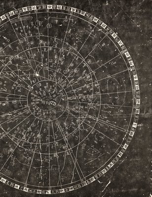
This work is a rubbing from an ancient Chinese Astronomy Chart, which was developed by Huangshang (1146-1194) in 1193. The chart was engraved on a stone stele by Wangzhiyuan, an official in charge of legal matters in the seventh year (1247) of the Chunyou reign of the Southern Song Dynasty. The original stone with three other stele of the Song Dynasty are held at the Confucius Temple (now the Stone Carving Museum) in Suzhou, Jiangsu province.
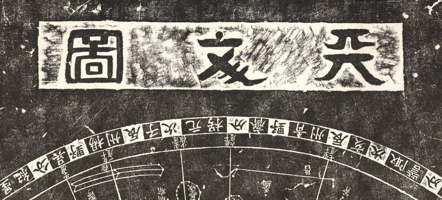
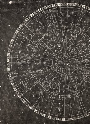
The carving on the stele is divided into two parts. At upper centre, three characters in Official Script reads: 'Astronomical chart ('tianwen tu')'. The astronomy chart takes the north celestial pole as the centre, using three concentric circles (the circle of perpetual apparition of the North Pole, the astronomical equator and the circle of perpetual occultation of the South Pole). The map also includes the lines of the twenty-eight lunar mansions to display the universe, containing 280 constellations and 1,434 fixed stars.
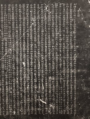
The text on the lower section contains 2,140 characters on 42 lines, which gives a brief explanation of the universe: the earth, the North Pole, the South Pole, the equator, the hosts of heaven, the causes of solar eclipse and lunar eclipse, and the astronomical knowledge of that time reflecting the level of awareness in Chinese ancient astronomy. Modern international astronomy experts have a very high opinion of the chart, believing it to be one of the world's oldest astronomical charts.
Asian Art Department, AGNSW, 2006.
-
Places
Where the work was made
China
-
Exhibition history
Shown in 1 exhibition
Under the Stars, Art Gallery of New South Wales, Sydney, 21 Mar 2020–07 Feb 2021